When traveling abroad, get a policy from one of the best travel insurance companies. You can get a 5% discount on Heymondo, the only insurance that pays all medical bills upfront for you, HERE!
Do you need a Philadelphia map so you don’t get lost in the “City of Brotherly Love”? I’ve been living in Philadelphia for more than three years, but it still feels like yesterday that I arrived at the Philly airport with two suitcases full of my stuff to live what has been the greatest adventure of my life: moving to another continent.
Beginnings are never easy, but the truth is that getting the best tourist maps of Philadelphia helped me a lot with getting to know the city.
If you’re visiting the biggest city in Pennsylvania and one of the most historic cities in the United States, I recommend having the following maps of Philadelphia on hand to plan your visit. In them, you will find the most important things to do in Philadelphia.
Below, you’ll find 10 maps of Philly that you can print out or save on your smartphone so you can check them at any time.
- Philadelphia tourist map
- Interactive map of Philadelphia
- Philly Center City District map
- Philadelphia street map
- Philadelphia neighborhood map
- Philadelphia SEPTA map
- Philadelphia road map
- High-resolution map of Philadelphia
- Map of the United States
- Map of Philadelphia for downloading
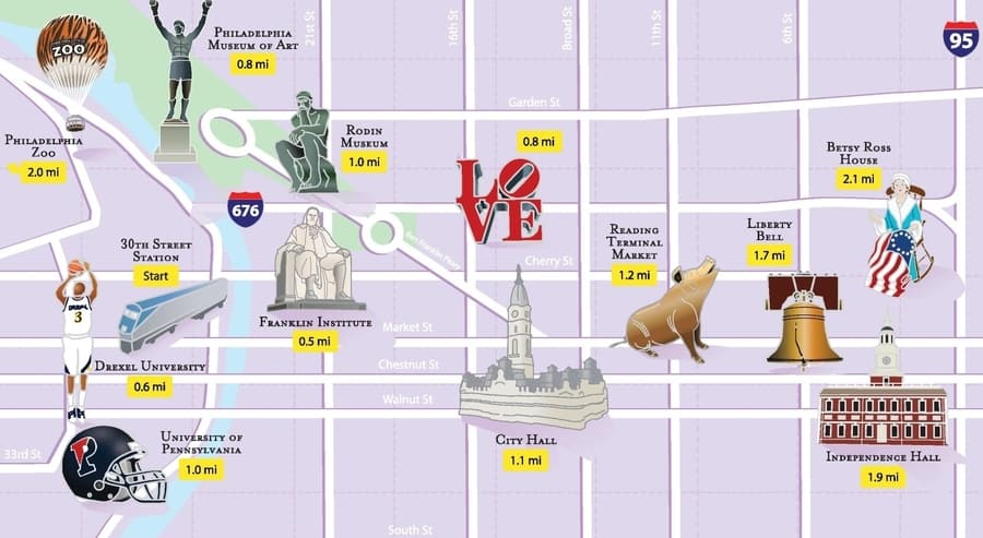
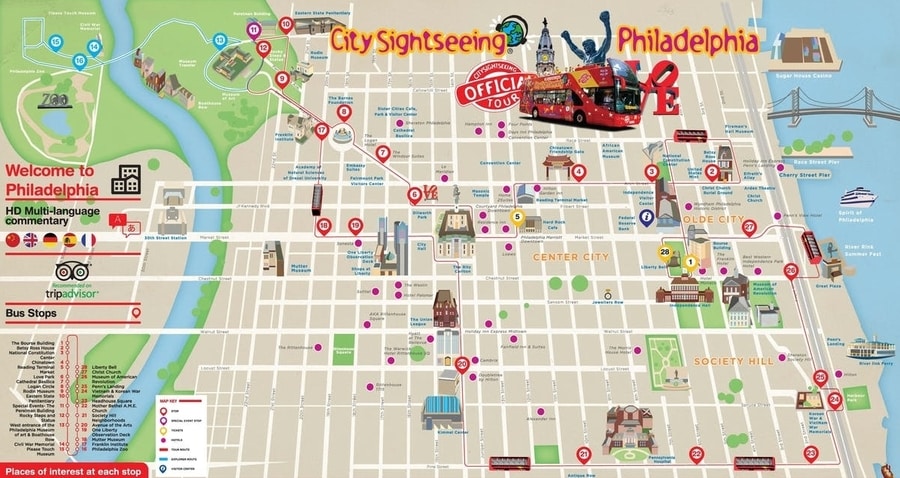
Philadelphia tourist map
This Philadelphia tourist map can be very useful for seeing the main points of interest in the city in a short time. You’ll be able to locate them quickly since it’s very visual.
Interactive map of Philadelphia
I’ve created an interactive map of Philadelphia so that you can find the places that I consider the most important and interesting. You can find everything from where the Rocky statue is located and where the main museums are to where to find the best attractions.
If you think I’ve forgotten any tourist spot worth visiting, leave me a comment and I’ll add it as quickly as I can.
Moreover, at the end of this article, I explain how you can check this map offline on your smartphone so you can always take it with you and use it during the trip.
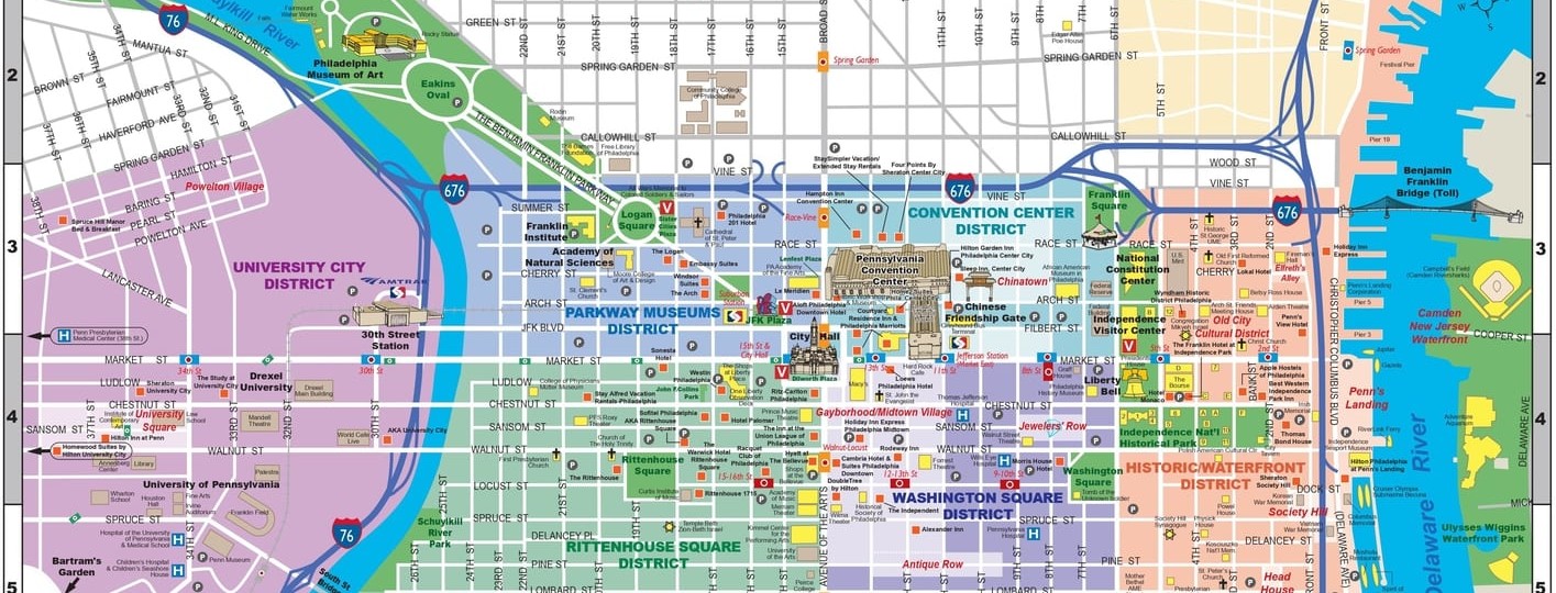
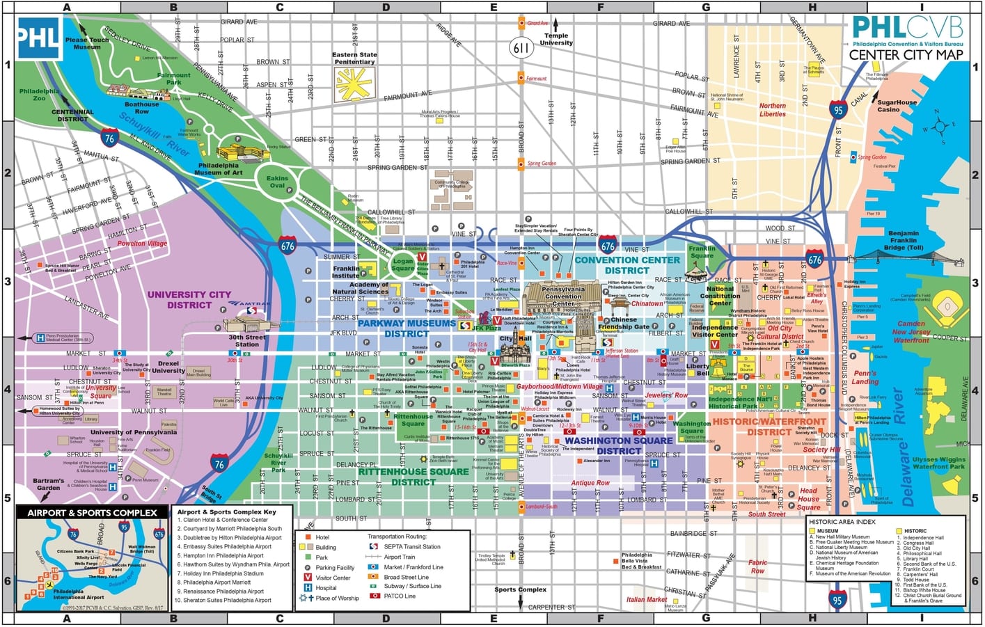
Philly Center City District map
Here is a Philadelphia Downtown map so you can plan your itinerary in the city. On the map, you’ll find the main attractions of Philadelphia, so if you don’t have much time to visit the city, this map will help you locate the most important places.
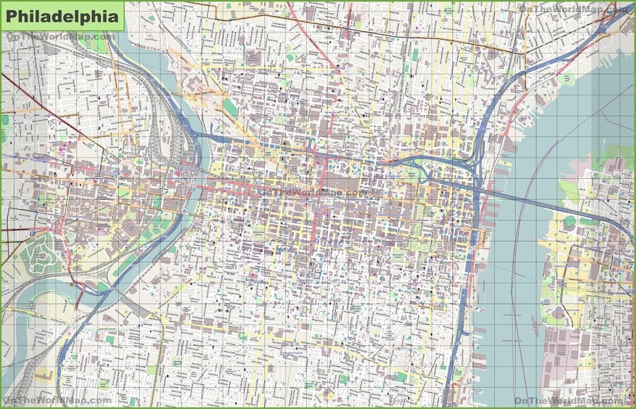
Philadelphia street map
Here is a Philadelphia street map so you don’t get lost in the city. If you click on it, it will zoom in so you can read the name of each of the streets of Philadelphia. It is the most thorough street map of Philly you can find.
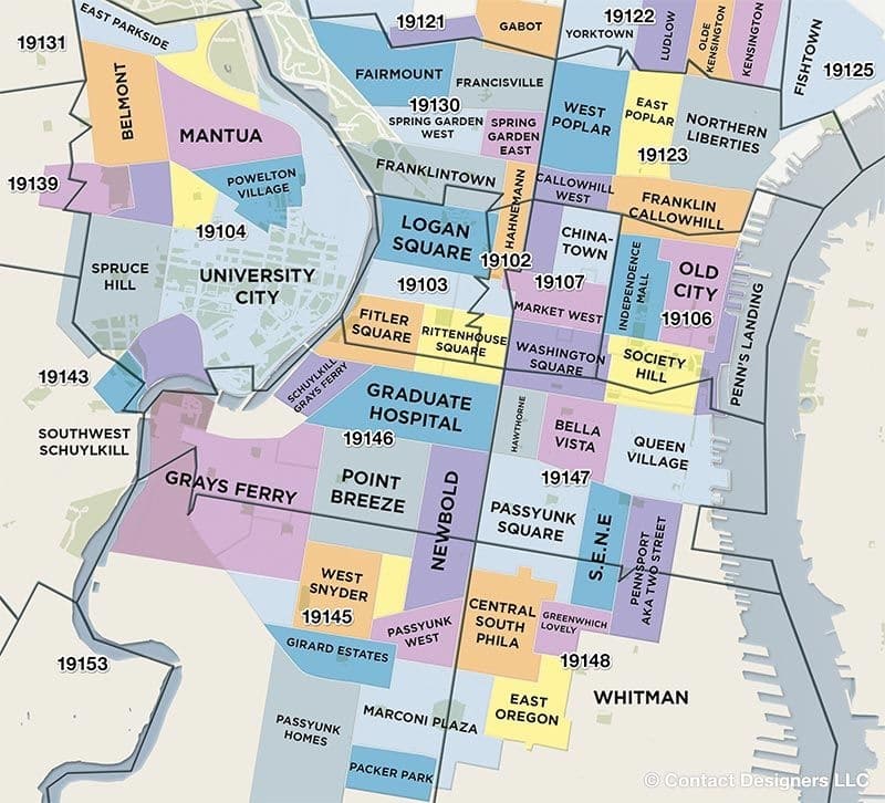
Philadelphia neighborhood map
This Philadelphia Neighborhood Map is very helpful for locating many of the main points of interest. It’s also great for finding the best place to stay in Philly.
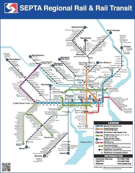
Philadelphia septa map
I’ve used this Philadelphia train map a lot. I think it’s essential to have it on hand so you can move around the city quickly and comfortably. The following map corresponds to the regional rail and transit rail line.
I’ve also used the bus quite often, which is the means of transport that I recommend for getting around the city center, although you can walk almost everywhere. If you need more information about public transportation in Philadelphia, you can find it here.
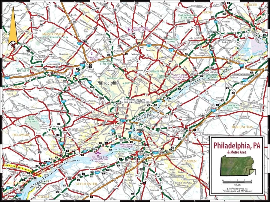
Philadelphia road map
I work on the outskirts of Philadelphia and usually drive to my office. If you want to visit one of the places in the surroundings of Philly, I’m sure you’ll also benefit from this Philadelphia road map.
High-resolution map of Philadelphia
If you don’t want to miss a single detail of the city, here is a high-resolution map of Philadelphia. You can zoom in and find any point.
Map of the United States
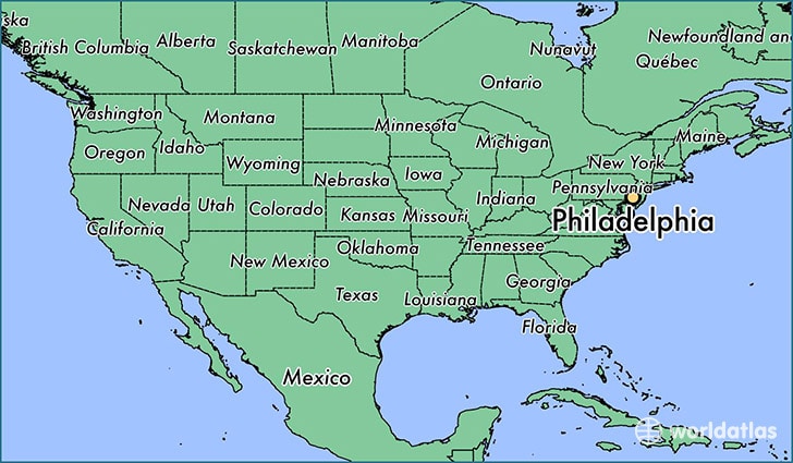
The map of the United States below will help you to locate Philadelphia within this great country. To give you some idea, Philadelphia is an hour and a half from New York and two and a half hours from Washington, DC.
Map of Philadelphia for downloading
To finish off, I also want to share a map of Philadelphia for downloading, which can be a great travel companion. If you follow the subsequent instructions, you’ll be able to check it even when you’re offline.
You’ll have to download the Maps.me and Dropbox applications; both are free and available for Android, iOS, and Windows operating systems. In Maps.me, search for “Philadelphia” and download all the information. Also, save the KML file that you downloaded on our website in Dropbox and open it from your phone using the Maps.me application so that all the additional information I’ve given you is stored.
And that’s it! Now you have all the Philadelphia maps you need to plan your visit.














Where would be a good place to stay for the 4th of July weekend with 3 kids, within walking distance to all the historical sites? Or neighborhood suggestion?
I recommend any of the three hotels on the Old City section of our guide on where to stay in Philadelphia. Specially, I recommend you stay at the Wyndham Philadelphia-Historic District.
Let me know if you have any other questions.
Ascen