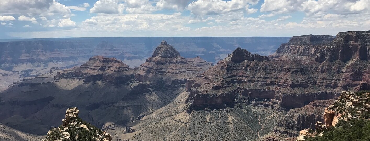
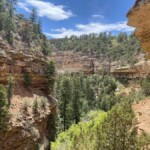
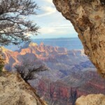
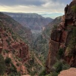
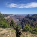
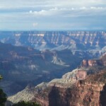
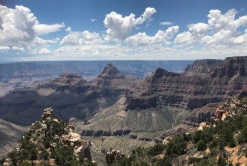
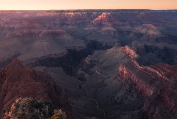
The Grand Canyon North Rim trails are undeniably one of the park’s main draws – at least, they were for me! With a diverse selection of hiking trails, you’ll never run out of options. Each trail offers its own unique combination of geological features, scenic landscapes, and rich flora and fauna, making the North Rim a paradise for outdoor enthusiasts.
Mid-May to mid-October is the best time to visit the Grand Canyon if you’re planning to hike the most secluded of its rims: the North Rim. During the winter, this area becomes inaccessible due to the snow, and the visitor center, restaurants, and accommodations shut down for the season.
We visited at the end of May and had so much fun hiking there. Best of all, the park wasn’t as full as it was in the middle of summer. That’s why, besides our generic guide on visiting the Grand Canyon, I decided to write this specific post on hiking the Grand Canyon North Rim trails. I’ll provide insights into route features, estimated time required, trail lengths, and other important details to help you plan your adventure. So, let’s dive in!
1. Bright Angel Point Trail, one of the best Grand Canyon North Rim hikes
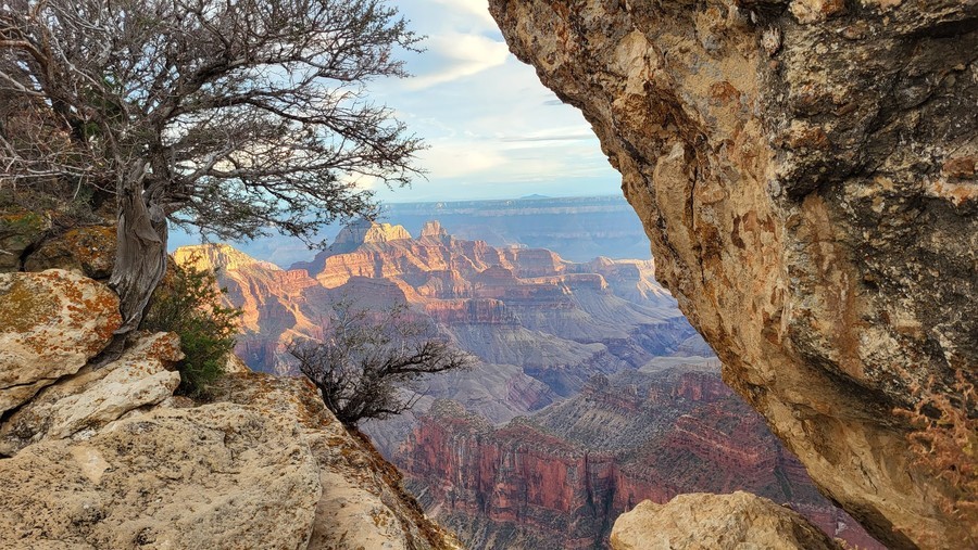
The Bright Angel Point Trail is one of the most famous hiking trails in the North Rim, offering a breathtaking diversity of landscapes. However, do not confuse it with the Bright Angel Trail in the South Rim. This trail offers a short journey from the verdant greenery of the Kaibab Plateau to the rugged pinyon and juniper forests, ultimately leading to the stunning Bright Angel Point, one of the most beautiful viewpoints in the Grand Canyon.
1. Bright Angel Point Trail, one of the best Grand Canyon North Rim hikes
You can kick off your adventure from either the Visitor Center or the Grand Canyon Lodge, known as one of the best hotels in the Grand Canyon. While the trail promises awe-inspiring panoramas, it does feature some steep sections and sheer drops, so it might not be the best choice if you’re afraid of heights. Nevertheless, it remains accessible for most visitors, including those with wheelchairs or strollers, with designated parking spots available at the trailhead.
As you walk along this hiking trail in the North Rim, you’ll be treated to a captivating display of nature’s wonders. However, it’s important to stay cautious, particularly during summer thunderstorms. If you spot lightning or hear thunder, it’s best to seek shelter at the nearby Grand Canyon Lodge for your safety.
- Duration: 30 minutes
- Distance: 1 mile
- Difficulty: Easy
- Route type: Out & back
- Elevation gain: 140 ft
2. North Kaibab Trail, a Grand Canyon North Rim hike to the bottom
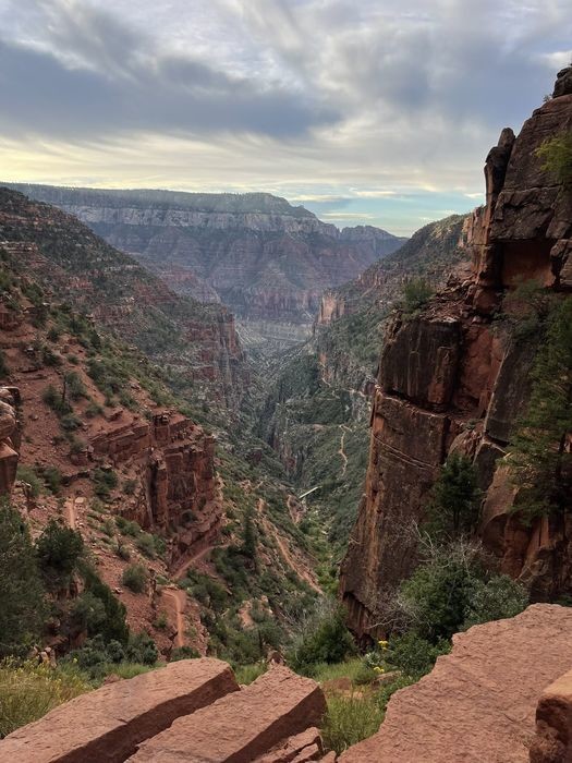
The North Kaibab Trail is the most challenging hike at the Grand Canyon North Rim. As you navigate its rugged terrain and encounter steep elevation changes, you’ll be greeted by the stunning landscape of fir and aspen trees, ferns, and wildflowers.
During your hike from the North Rim to the bottom of the Grand Canyon, you’ll enjoy jaw-dropping views of the Colorado River. However, reaching the river requires about 4 to 6 hours of arduous hiking, spanning roughly 16 miles with a staggering 6,600-foot elevation change. And remember, the hike back up is even more challenging, so I only recommend it for those in peak physical condition.
2. North Kaibab Trail, a Grand Canyon North Rim hike to the bottom
If you’re looking for an easier alternative, consider hiking the 8-mile trail from the North Kaibab trailhead down to Roaring Springs, which typically takes about 4 to 6 hours round-trip.
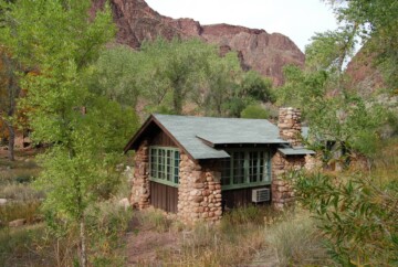
However, if you’re up for the ultimate challenge, consider tackling the Rim-to-Rim Trail. Begin your journey from the North Kaibab Trailhead and descend to the Colorado River below. From there, you can continue your hike either via the South Kaibab Trail or the Bright Angel Trail to get to the South Rim. There, you can take a shuttle back to the North Rim if you want. Since it’s a multi-day adventure (I recommend doing it over 3 days), you could opt to camp in the Grand Canyon at Bright Angel Campground or stay overnight at Phantom Ranch, known for offering some of the best cabins in the Grand Canyon.
I strongly advise against attempting the North Rim hike below the rim during hot months. And remember that the North Rim is closed in winter, so your best bet is at the beginning or end of the open season.
- Duration: 8-12 hours
- Distance: 28 miles
- Difficulty: Strenuous
- Route type: Out & back
- Elevation gain: 5850 ft
3. Widforss Trail, one of the top North Rim hikes
The Widforss Trail is one of the best day hikes in the Grand Canyon North Rim, named after Gunnar Widforss, a talented artist famous for his National Park paintings. This is a 9-mile round trip hike, offering a captivating blend of panoramic canyon vistas and serene ponderosa pine forest landscapes. The initial 3-mile stretch follows the rim of Transept Canyon, offering an ideal setting to pause and enjoy the breathtaking views before returning to the trailhead.
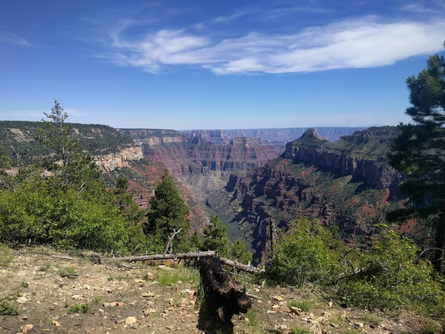
3. Widforss Trail, one of the top North Rim hikes
The Widforss Trail is one of the most popular Grand Canyon hiking routes with relatively easy terrain and moderate elevation changes, ensuring an enjoyable hike in the North Rim. Keep in mind that while mornings may start a bit chilly, the trail warms up gradually as you venture toward the canyon’s edge. When we hiked this trail in May, it was truly a highlight of our trip. The weather was pleasant, and the sky was clear, making for an unforgettable experience.
- Duration: 4-5 hours
- Distance: 9 miles
- Difficulty: Moderate
- Route type: Out & back
- Elevation gain: 1000 ft
4. Transept Trail, one of the most scenic North Rim hiking trails
Looking for one of the top hikes in the Grand Canyon North Rim? I suggest exploring the Transept Trail, which links the Grand Canyon Lodge and Visitor Center to the North Rim Campground. This scenic route follows the rim of the Transept Canyon through groves of quaking aspens, gamble oaks, and ponderosa pines.
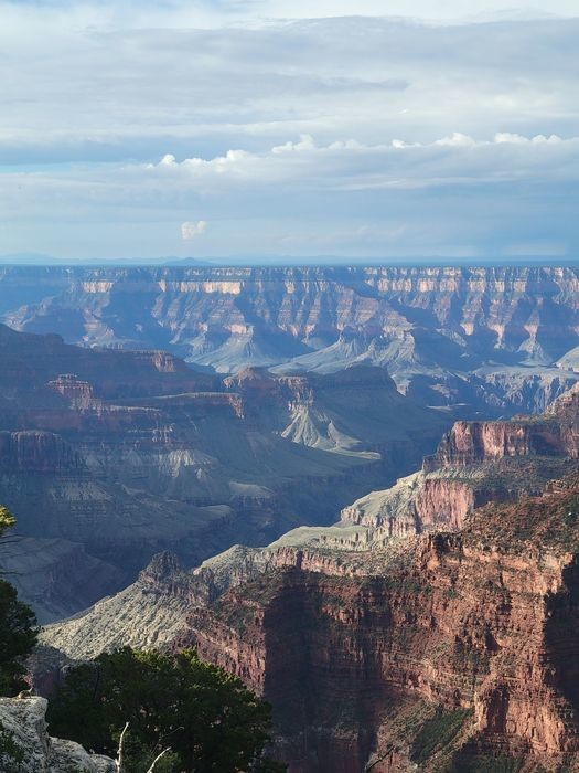
4. Transept Trail, one of the most scenic North Rim hiking trails
While not paved, this trail isn’t too difficult, as it features gentle slopes and low elevation changes, making it one of the most popular hikes in the Grand Canyon North Rim. Along the way, keep an eye out for an ancestral Puebloan ruin about midway to the campground, marked by a line of rocks.
Though the views of the Grand Canyon’s North Rim may not be as expansive as in other areas, the trail still offers glimpses of stunning cliff formations. Plus, you’re likely to spot some of the most commonly seen animals in the Grand Canyon, including mule deer and other native species.
- Duration: 1-2 hours
- Distance: 3.7 miles
- Difficulty: Easy
- Route type: Out & back
- Elevation gain: 348 ft
5. Cape Final Trail, one of the family-friendly trails in the North Rim
The Cape Final Trail stands out as one of the best hikes at the Grand Canyon North Rim. The trail gently meanders through the woodland, offering breathtaking views and a serene atmosphere for hikers to immerse themselves in.
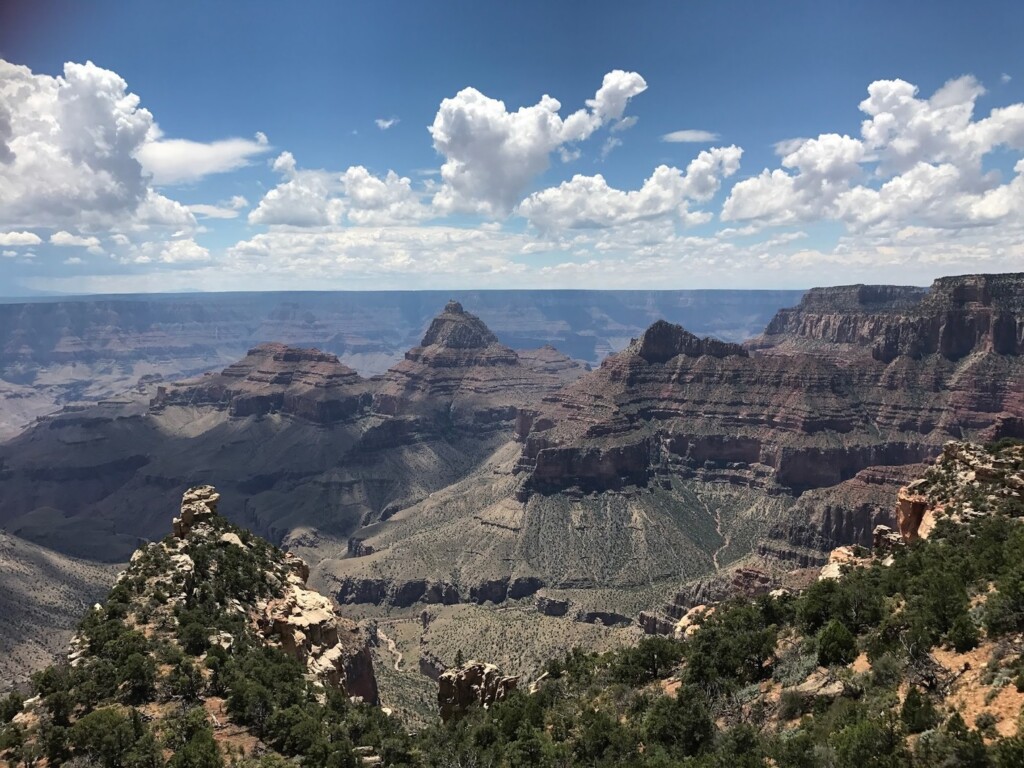
5. Cape Final Trail, one of the family-friendly trails in the North Rim
You will find the trailhead after driving 30 minutes along the North Rim Scenic Drive. As you continue along this North Rim trail, the landscape gradually changes, revealing expansive vistas of red buttes and cliffs around the upper end of Lava Creek. Once you reach Cape Final, you are treated to one of the most spectacular viewpoints you’ll ever see in your life. Moreover, at the last half-mile of the trail, you’ll find a single camping spot under the starry sky. You need to be really lucky to get the only backcountry permit that will allow you to stay there for the night, but it’s worth the try.
In any case, with its gentle terrain, shaded pathways, and stunning vistas, the Cape Final Trail is one of the top attractions in the Grand Canyon North Rim. So, don’t miss it!
- Duration: 1-2 hours
- Distance: 4 miles
- Difficulty: Easy
- Route type: Out & back
- Elevation gain: 500 ft
6. Cape Royal Trail, a short hike at the North Rim of the Grand Canyon
The Cape Royal Trail is a 1-mile, out-and-back route renowned for its breathtaking views. It’s also the last stop of the 20-mile North Rim Scenic Drive, also known as Cape Royal Road. As you stroll along this paved path, you’ll likely encounter fellow explorers enjoying one of the best hikes in the North Rim of the Grand Canyon.
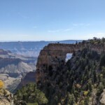
The Cape Royal Viewpoint offers unrivaled vistas that may just be the most awe-inspiring in the entire Grand Canyon. I highly recommend taking a leisurely walk along the side path to Angel’s Window, a natural arch framing the Colorado River 5,000 feet below.
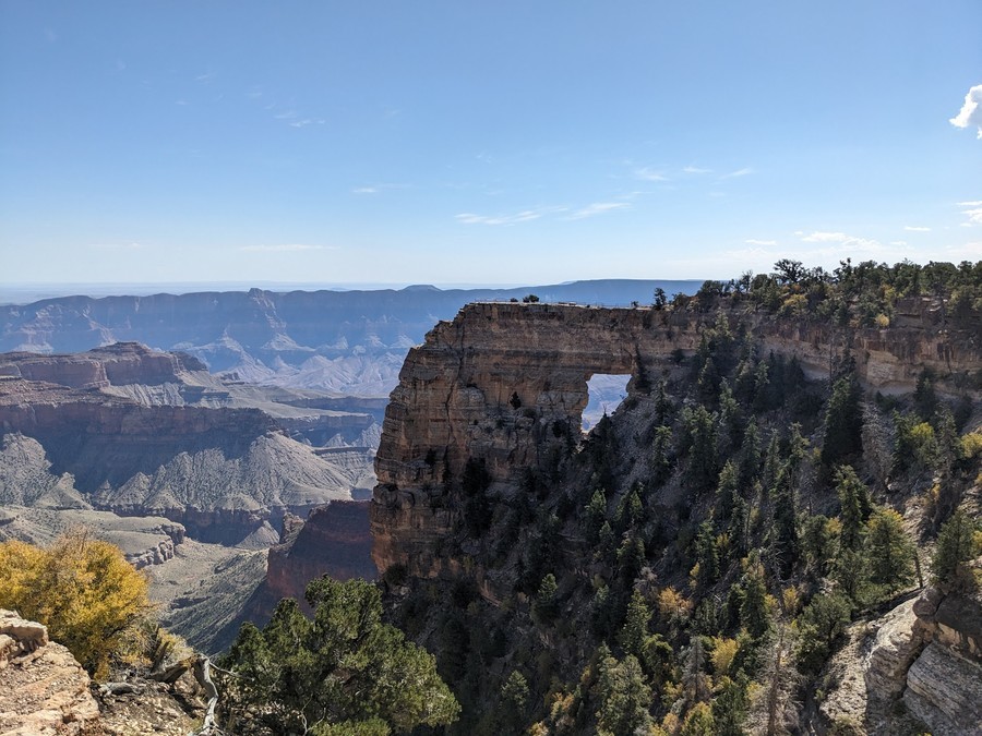
6. Cape Royal Trail, a short hike at the North Rim of the Grand Canyon
With its flat terrain, guardrails, chain-link fencing, and wheelchair accessibility, this trail is definitely one of the most popular hikes in the Grand Canyon North Rim. At every turn, I had my camera ready to capture the beauty of the canyon – the views were simply magnificent!
- Duration: 20 minutes
- Distance: 1 mile
- Difficulty: Easy
- Route type: Out & back
- Elevation gain: 65 ft
7. Cliff Spring Trail, one of the easier hiking trails in the Grand Canyon North Rim
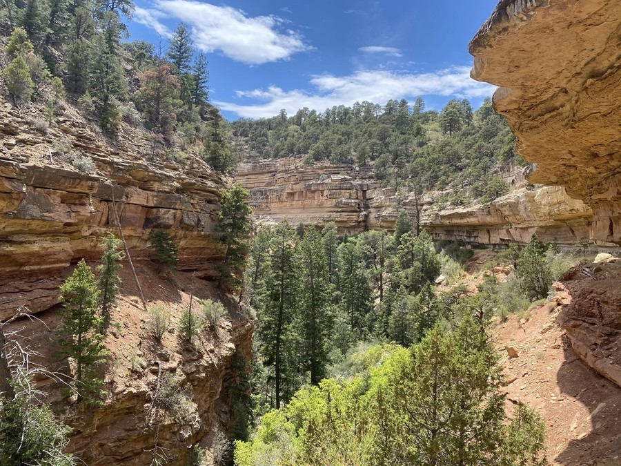
The Cliff Spring Trail is one of my favorite hiking trails in the Grand Canyon North Rim. It’s a short but enjoyable hike through a path that begins at a pullout on the left side of the scenic road, just 0.3 miles before the Cape Royal trailhead.
7. Cliff Spring Trail, one of the easier hiking trails in the Grand Canyon North Rim
As you venture along the trail, you’ll pass through a forested ravine and encounter fascinating sights, including an archaeological site with a Puebloan granary. Approximately 0.4 miles from the trailhead, you will find the spring, but unfortunately, its water isn’t safe to drink.
Most hikers turn around here, but if you want to get to the end, you should know that the trail gets a little more rocky and clearly less traveled, with some rock slides on the path and lots of ups and downs. If you want to venture past the spring, I suggest making sure you have a good sense of balance and sure footing.
- Duration: 1 hour
- Distance: 2 miles
- Difficulty: Moderate
- Route type: Out & back
- Elevation gain: 510 ft
8. Point Imperial Trail, a North Rim trail from the highest viewpoint in the Grand Canyon
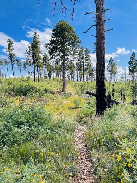
Point Imperial, standing at 8,803 feet, is the highest viewpoint on the Grand Canyon, offering incredible, wide-open views to the east and south-southeast. I was expecting to have similar views along the trail that has its name and starts from its parking lot. However, I’m not going to lie; I got a little disappointed and turned around before the end of the Point Imperial Trail.
This is a 6-mile, out-and-back route that culminates at the northern park boundary, where you can connect with other trails in the Saddle Mountain Wilderness of the Kaibab National Forest.
8. Point Imperial Trail, a North Rim trail from the highest viewpoint in the Grand Canyon
Typically, it takes around 2 hours to complete this trail, but I only hiked for an hour or so. The hike, or at least the first 1.5 miles I hiked, were pretty boring, with no views of the canyon. Besides, the trail winds through areas impacted by the 2000 Outlet Fire and much of the path was pretty overgrown, with many thorny bushes. So, if you attempt to hike it, wear long pants.
I still decided to include this trail in our hiking guide to the North Rim because we met some hikers completing the Nankoweap Trail that connects with the Point Imperial Trail, and they told us it was the best hike of their lives. Also, take into account that this is a multi-day route, with wonderful camping opportunities. If you’re looking for the best day hikes in the Grand Canyon North Rim, you’re better off choosing another trail on this list.
- Duration: 2-3 hours
- Distance: 6 miles
- Difficulty: Moderate
- Route type: Out & back
- Elevation gain: 450 ft
9. Ken Patrick and Uncle Jim Trail, one of the best day hikes in the Grand Canyon North Rim
The Uncle Jim Trail is one of the few loop trails in the Grand Canyon North Rim. This 5-mile path is a bit challenging and rocky in certain areas, but you can complete it in about 2 hours. Starting from the North Kaibab Trailhead, a little north of the North Rim Campground, you can venture through the forest along the Ken Patrick Trail for 0.9 miles before veering right for another 0.4 miles. At this point, both left and right paths lead to the same loop: the Uncle Jim Loop Trail.
9. Ken Patrick and Uncle Jim Trail, one of the best day hikes in the Grand Canyon North Rim
Keep in mind that the Ken Patrick Trail continues east after the loop connection, but it’s nearly impassable, so it’s best to stick to the Uncle Jim Trail. While hiking these routes, be prepared for muddy and occasionally smelly sections due to mule traffic. Despite these challenges, the natural beauty and stunning views make the journey truly worthwhile.
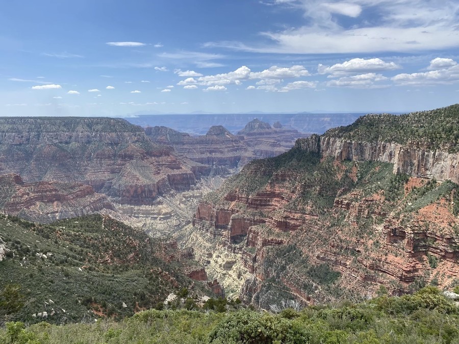
Once you reach the end of the trail, you are greeted by the Uncle Jim Trail Overlook, which showcases panoramic views of Bright Angel and Roaring Springs canyons, as well as notable landmarks such as Bright Angel Point, Deva Temple, Zoroaster Temple, Brahma Temple, and even Bill Williams Mountain in the distance. With its varied terrain and captivating vistas, it ranks among the most unique North Rim trails.
- Duration: 2-3 hours
- Distance: 5 miles
- Difficulty: Moderate
- Route type: Loop
- Elevation gain: 770 ft
10. North Rim Lookout Tower, an easy hike through Grand Canyon North Rim forests
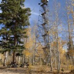
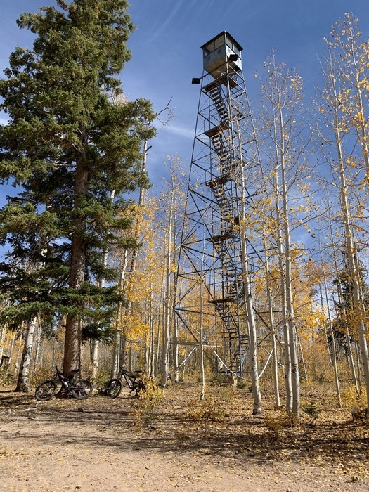
The North Rim Lookout Tower Trail offers a round-trip hike spanning 2.8 miles, leading you to the North Rim Lookout Tower amidst stunning scenery. To begin your journey, you can park at the entrance station, then take a stroll past park residences until you reach the trailhead.
10. North Rim Lookout Tower, an easy hike through Grand Canyon North Rim forests
This trail is considered an easy route, typically taking about 1 hour to complete, making it one of the best trails in the Grand Canyon North Rim. Once you arrive at the lookout tower, get ready to enjoy breathtaking views of the expansive Kaibab Forest.
However, it’s important to note that the tower itself isn’t open to the public, and its top remains locked. While it’s possible to climb the watchtower, it might feel a bit scary as it hasn’t undergone repairs. Nevertheless, the North Rim Lookout Tower Trail provides a rewarding experience for nature enthusiasts looking for the best hikes in the Grand Canyon North Rim and some of the most iconic wildlife in the park. Bison herds are often seen grazing on the Kaibab Plateau.
- Duration: 1 hour
- Distance: 2.8 mile
- Difficulty: Easy
- Route type: Out & back
- Elevation gain: 360 ft
Grand Canyon North Rim hiking trails map
Below, I’ve included a map of hiking trails in the North Rim to help you plan your thrilling adventures. And don’t forget to check out our guide to all the other Grand Canyon North Rim maps, which will help you in navigating the area more efficiently.
Other tips for hiking in the Grand Canyon North Rim
Now that you know the best hiking trails in the Grand Canyon North Rim, here are some additional tips to keep in mind:
- Your Grand Canyon packing list for hiking in the North Rim should include essential items like plenty of water, high-energy snacks, and a flashlight. Weather can change rapidly around here, so bring layers and sun protection.
- While you can explore the area on your own, there are some good Grand Canyon North Rim tours you can sign up for in case you prefer to hike with an experienced guide.
- If camping at the Grand Canyon North Rim is on your agenda, make sure to reserve your spot in advance at the North Rim Campground – the only developed campsite in the North Rim. Backcountry camping is also allowed in some areas of the Grand Canyon North Rim, including the primitive Tuweep Campground, but you will need a backcountry permit.
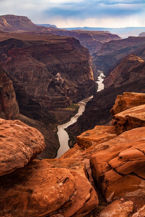
Other tips for hiking in the Grand Canyon North Rim
- If you’re planning to visit the Grand Canyon in winter, remember that the North Rim will be closed to private vehicles due to harsh weather conditions and heavy snowfall. I recommend visiting one of the other rims instead.
- Entrance fees to the national park are $35 per private vehicle or $20 per person. During the open season, the entrance station operates 24 hours, while the North Rim Visitor Center is open from 8:00 a.m. to 5:00 p.m. For more detailed information, refer to our guides on Grand Canyon entrance fees and Grand Canyon operating hours.
- And lastly, it’s always a good idea to understand the differences between the North Rim vs. South Rim. North Rim hiking trails tend to be less crowded and offer a different perspective of the canyon’s beauty. However, they may also be more challenging due to higher elevations.
And that’s all about the best hiking trails at the Grand Canyon North Rim. I hope this information helps you plan your visit and have a fantastic time. If you have any questions or want to share your experience, feel free to leave a comment below.
Bon voyage!
