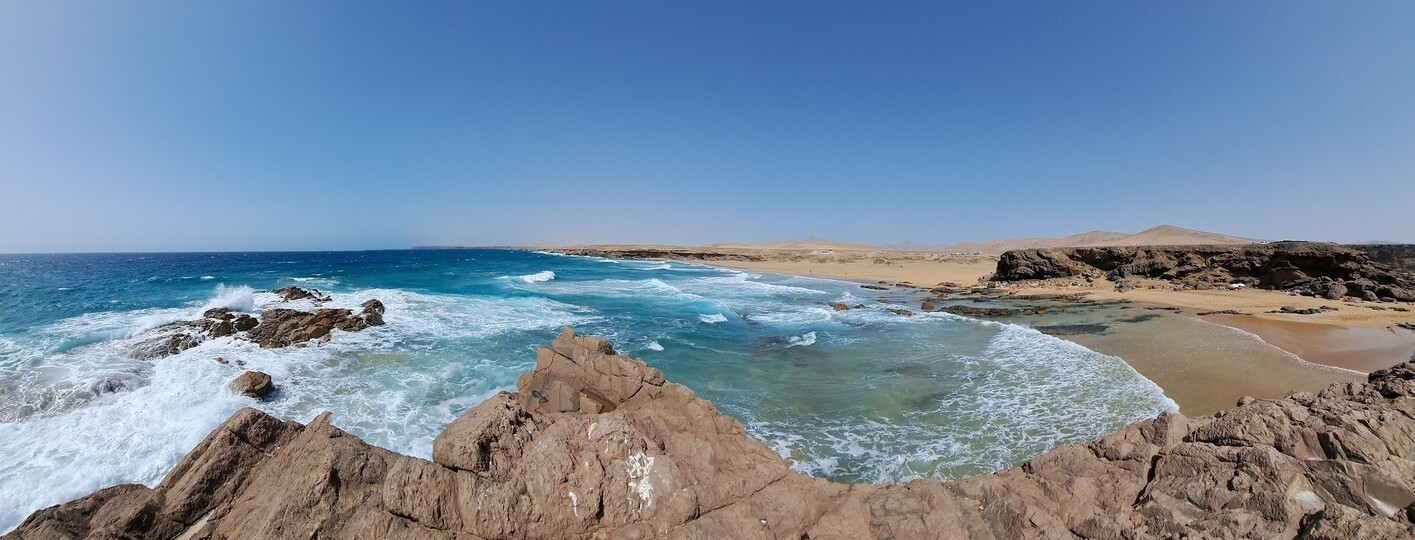
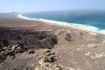
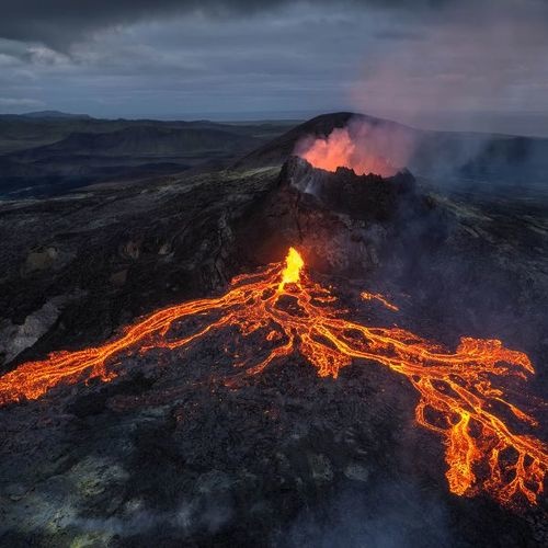
Fuerteventura is an island destination where you’ll find a wide variety of activities, including the most scenic Fuerteventura hiking trails. Not only are there abundant wild and paradisiacal beaches but also volcanic landscapes that make hiking in Fuerteventura an absolute treat.
In addition to visiting the must-see attractions in Fuerteventura, it’s worth taking the time to explore some of the island’s best walking trails. While my favorite is the ascent to Calderón Hondo Volcano, there are other hiking trails in Fuerteventura, so you can find one that fits your activity level and schedule.
In this guide, I’m sharing the best places to go trekking in Fuerteventura along with a Fuerteventura hiking map to help you plan your trip.
1. Calderón Hondo Volcano, one of the most famous hikes in Fuerteventura
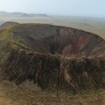
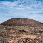
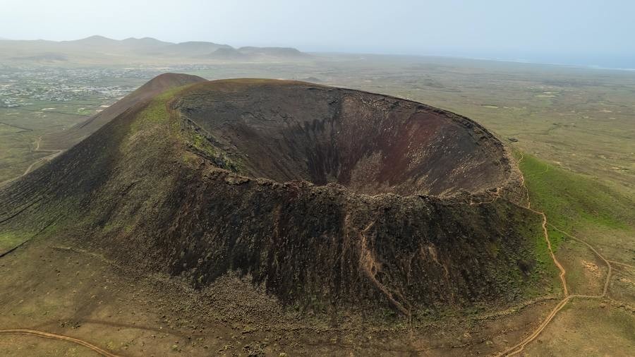
Hands down, the ascent to the Calderón Hondo Volcano is one of the best hiking trails in Fuerteventura. It takes you to the incredible crater summit, which is 912 feet tall and offers breathtaking views. This hike is one of the best things to do near Corralejo, and it’s suitable for families, so don’t miss it.
If you’re traveling with children, there’s no need to worry. This trail is well-maintained and relatively easy, with no significant challenges. That said, the volcanic landscapes you’ll witness from the top are truly out of this world, making it an excellent choice for those looking for a unique and exciting adventure.
1. Calderón Hondo Volcano, one of the most famous hikes in Fuerteventura
If you want to delve deeper into the history and origin of the island’s volcanoes, some of which are over 5,000 years old, I highly recommend taking this guided tour. It also includes a stop in the charming town of Lajares, where you can enjoy traditional Canarian cuisine and relax.
Alternatively, you can explore this Fuerteventura walking trail on your own. It should take you around 1.5 hours to complete. The trail begins at the Calderón Hondo Volcano parking lot, and you’ll need to cover a 1.5-mile distance to reach the top. Once at the top, I suggest walking around the perimeter of the crater, which is 230 feet deep and has a yellow hue due to the presence of sulfur. To return to the parking area, simply retrace your steps.
- Duration: 1.5 hours
- Distance: 3.1 mi
- Difficulty: Easy
- Type: Circular
- Elevation gain: 525 ft
- Starting point: Camel Rides Lajares (La Cancela Street)
2. Gran Valle – Playa de Cofete, a stunning Fuerteventura hike with dreamlike landscapes
The Gran Valle – Playa de Cofete trail offers one of the best hikes in Fuerteventura. This path takes you through some of the best attractions in the Jandía Peninsula, showcasing panoramic views that will leave you speechless.
The trail begins near the dirt road connecting Morro Jable with Punta de Jandía. To help you navigate the route, signposts are placed at the entrance, offering insights into the local flora and fauna.
2. Gran Valle – Playa de Cofete, a stunning Fuerteventura hike with dreamlike landscapes
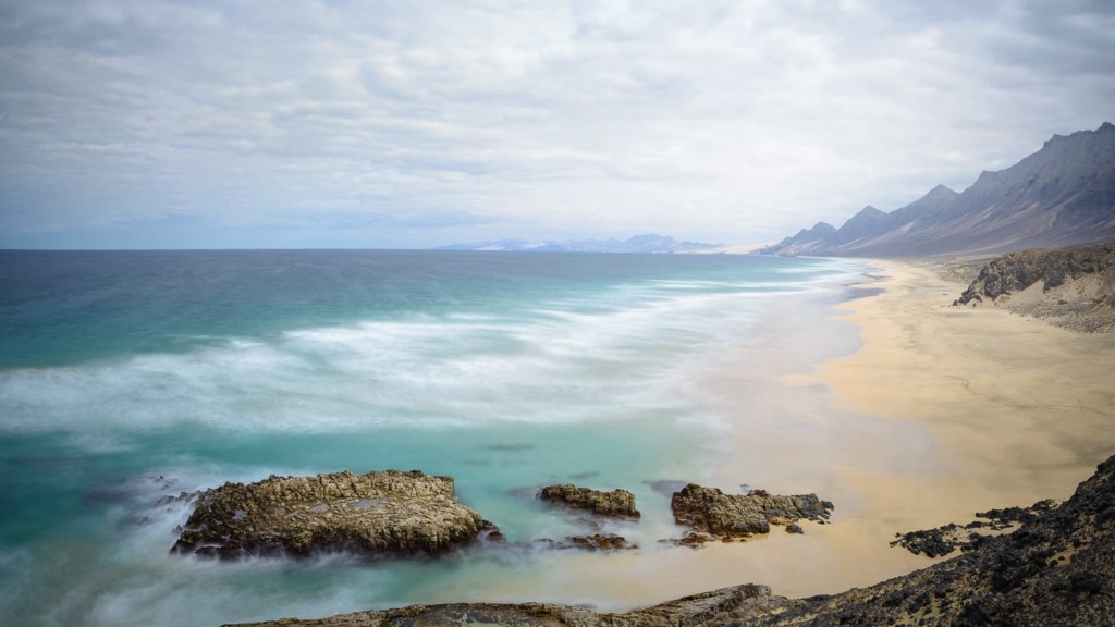
As you make your way into the valley, you’ll encounter towering mountain formations, remnants of ancient dwellings, and the iconic Cardon de Jandía cacti. This blend of nature, history, and breathtaking landscapes creates an unforgettable experience, making it one of the best walks in Fuerteventura.
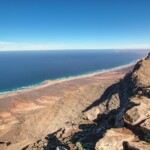
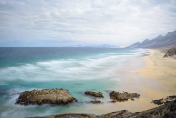
As you progress, you’ll begin a gentle ascent to Degollada de Cofete, the highest point on this route, boasting magnificent views of Cofete Beach, one of the best beaches in Spain, along with the enigmatic Villa Winter and the village of Cofete.
If hiking isn’t your cup of tea but you still wish to explore this incredible beach, I recommend this 4×4 tour. To access this beach by car, you will have to travel along a poorly-maintained road perched on a steep cliff. It’s well worth it, so don’t miss the opportunity to visit.
- Duration: 2.5 hours
- Distance: 4.2 miles
- Difficulty: Easy
- Type: Roundtrip
- Elevation gain: 941 ft
- Starting point: Cofete
3. Pico de la Zarza, a Fuerteventura hiking route with incredible views
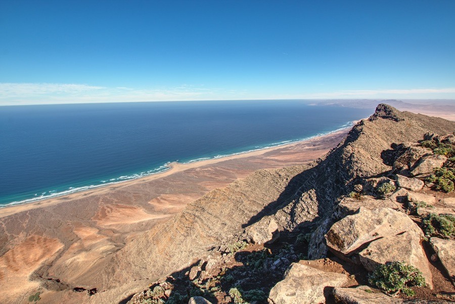
One of the best attractions in Morro Jable is Pico de la Zarza, where you can experience the highest point on the island. This Fuerteventura trail leads you to this magnificent viewpoint, making it an excellent choice for hiking enthusiasts.
Moreover, the trail is well-marked and relatively easy, so you will not need a lot of hiking experience. The journey begins behind the Hotel Occidental Jandía Mar, one of the best hotels in Morro Jable, where you can conveniently park your car before embarking on the hike.
3. Pico de la Zarza, a Fuerteventura hiking route with incredible views
Over the course of approximately 4.5 miles, you’ll gradually ascend and be able to witness a transformation in the landscape’s colors. Vegetation gradually recedes, revealing panoramic views of the surrounding beaches.
If you’re planning your itinerary and contemplating activities to include, you probably need a place to relax as well. A great idea would be spending a few hours on one of the beaches of Morro Jable or recharging your batteries at one of Fuerteventura’s best restaurants in the area.
- Duration: 4.5 hours
- Distance: 8 miles
- Difficulty: Easy
- Type: Roundtrip
- Elevation gain: 2276 ft
- Starting point: Behind the hotels on Calle Sancho Panza in Morro Jable
4. Barranco de los Enamorados, one of the best Fuerteventura hiking trails for beginners
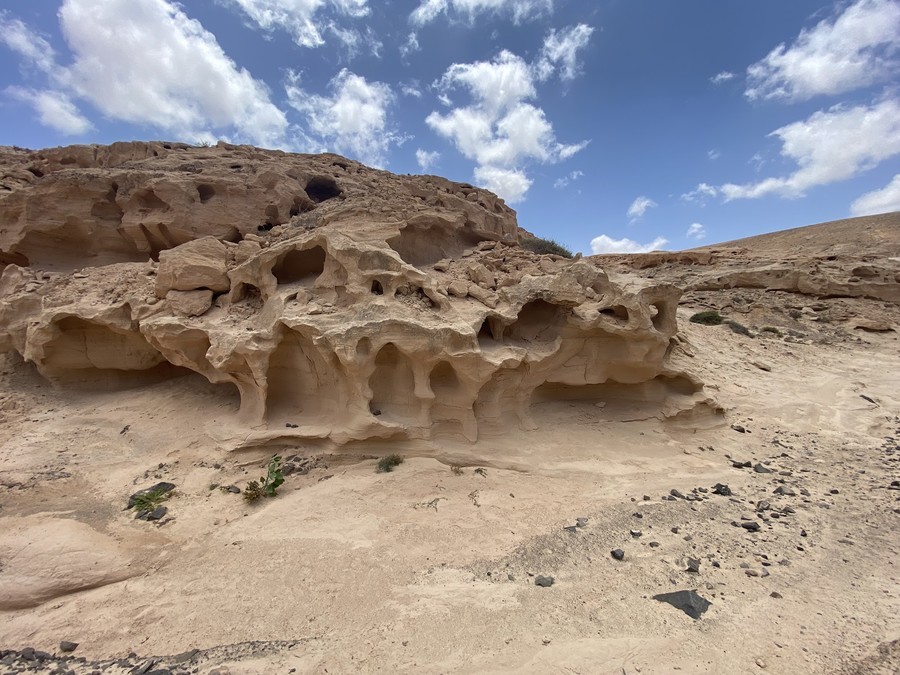
Another excellent Fuerteventura hiking trail is the one that takes you to Barranco de los Enamorados. This unique location has a long history, dating back around 135,000 years. Pretty impressive, right?
During that era, significant erosion exposed the sandbanks that lay beneath the water’s surface. It’s astonishing to witness the ground covered in marine fossils as you walk, providing a glimpse into a unique natural landscape of historical significance. It’s good to know that this location yielded the first remains of a terrestrial gastropod species, making it a remarkable discovery.
4. Barranco de los Enamorados, one of the best Fuerteventura hiking trails for beginners
You can access this trail from various towns, including Lajares and Tindaya, but El Cotillo is the most popular starting point. El Cotillo is also the most picturesque of the three towns, allowing you to combine both visits in a single day and optimize your time.
This Fuerteventura hike is relatively easy, and the best time to explore it is in the morning to avoid the intense heat. You should be able to complete it in around 2 hours, but I recommend allocating extra time to take pictures and explore at your own pace.
- Duration: 2 hours
- Distance: 4 miles
- Difficulty: Easy
- Type: Roundtrip
- Elevation gain: 393 ft
- Starting point: End of the dirt road of Barranco de los Enamorados
5. Barranco de las Peñitas, an easier hike in Fuerteventura
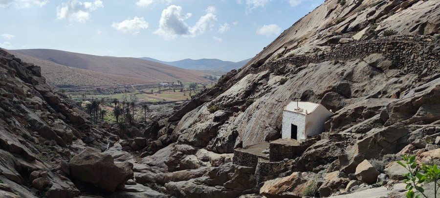
For those seeking a place to hike in Fuerteventura that’s less touristy, Barranco de las Peñitas is the perfect choice. Located within the protected natural area of the Betancuria Rural Park, it provides a magical environment for those who want to connect with nature.
The landscape is nothing short of spectacular, as you’ll be surrounded by towering mountain walls reaching up to 150 feet, as well as abundant green vegetation. Along the way, you’ll encounter the Malpaso hermitage, a palm grove, and the Peñitas arch – three iconic sites within this protected area.
5. Barranco de las Peñitas, an easier hike in Fuerteventura
The trail spans 2.4 miles and commences in the small town of Vega de Río Palmas. If you’re short on time, this is a great option, as 2 hours should be enough to complete this Fuerteventura hike.
Here, you’ll also find caves and aboriginal rock carvings, making it an excellent opportunity to delve into its history. If you have time, I recommend signing up for one of the most interesting excursions in Fuerteventura for a comprehensive exploration of this area. For example, this coastal tour is a great way to hear all the legends surrounding this site, and it includes a guided visit to the fishing village of Ajuy.
- Duration: 2 hours
- Distance: 4.3 miles
- Difficulty: Intermediate
- Type: Circular
- Elevation gain: 800 ft
- Starting point: Vega de Río Palmas
6. Playa de Jarugo, a beautiful hike on the Fuerteventura coast
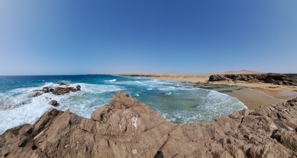
The path leading to Jarugo Beach is one of the best trails in Fuerteventura for hiking enthusiasts who also wish to enjoy a refreshing swim. The route begins in the town of Los Molinos, on the western side of the island, and follows the coastline all the way to Jarugo Beach.
6. Playa de Jarugo, a beautiful hike on the Fuerteventura coast
As you traverse the route, you’ll pass by breathtaking cliffs often inhabited by seagulls and other seabirds. Additionally, you’ll find numerous detours branching off the original 6.2-mile trail, leading to picturesque coves, natural pools, and secluded landscapes. So, if you’re looking for an escape from the tourist crowds, this is an ideal choice.
I recommend dedicating a full day to this Fuerteventura hike. You can start early and alternate between hiking, sunbathing, and refreshing swims.
- Duration: 3 hours
- Distance: 6.2 miles
- Difficulty: Intermediate
- Type: Roundtrip
- Elevation gain: 988 ft
- Starting point: Los Molinos
7. Montaña de la Arena, one of the best hikes in Fuerteventura
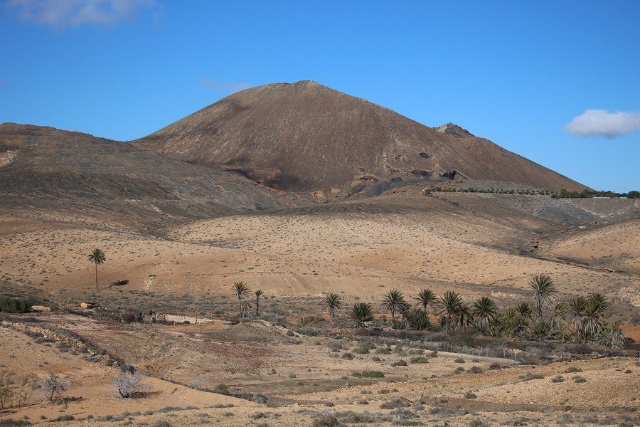
Montaña de la Arena is one of the most attractive volcanoes in Fuerteventura, making a hike to its crater a highly recommended tourist activity. This volcano has two craters and is exceptionally well-preserved, offering a unique landscape that will leave you in awe.
To reach the top, you’ll need to cover approximately 5 miles through a sea of solidified volcanic lava. Once at the top, you’ll be rewarded with absolutely stunning panoramic views, with Tindaya Mountain in the background.
7. Montaña de la Arena, one of the best hikes in Fuerteventura
This Fuerteventura hike is for intermediate levels and should take around 3 hours to complete. You should begin your journey in the town of La Oliva, where you’ll find signs leading to the trailhead.
- Duration: 3 hours
- Distance: 5.3 miles
- Difficulty: Intermediate
- Type: Circular
- Elevation gain: 820 ft
- Starting point: Los Cabrera Street on the FV-101 road from La Oliva towards Villaverde
8. Caleta Negra, a Fuerteventura hiking trail with volcanic landscapes
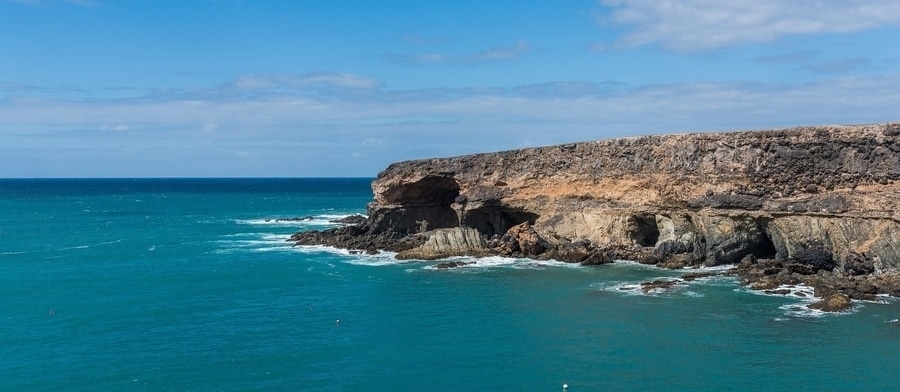
Ajuy Beach is one of the most beautiful beaches in Fuerteventura, so visiting it is a must-do while on the island. Better yet, you can combine your beach day with a Fuerteventura hike to Caleta Negra.
As you hike, you’ll encounter natural caves and stone walls with spectacular shapes, sculpted by thousands of years of wind and water exposure. The most impressive of them all is the large Ajuy Caves, which is characterized by its sea breeze and deep silence.
8. Caleta Negra, a Fuerteventura hiking trail with volcanic landscapes
This is an intermediate hiking trail in Fuerteventura, so it typically takes around 1.5 hours to complete. The coastal views are genuinely breathtaking, so remember to bring your camera and give yourself extra time to enjoy the various panoramic viewpoints.
- Duration: 1.5 hours
- Distance: 2.8 miles
- Difficulty: Intermediate
- Type: Circular
- Elevation: 440 ft
- Starting point: Puerto de la Peña
9. Sendero Bayuyo, one of the most popular Fuerteventura hiking routes
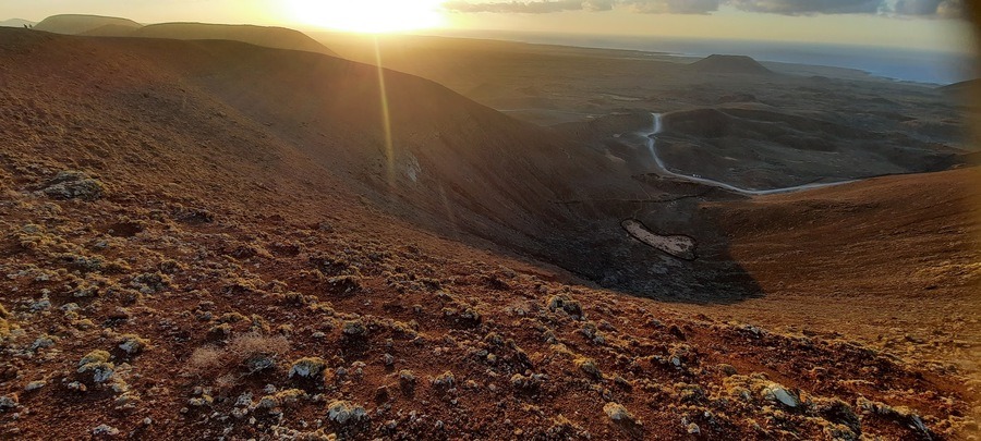
The Bayuyo Trail is one of the most famous Fuerteventura hiking trails, offering an opportunity to explore its mesmerizing volcanic landscapes. This trail is part of an extensive network connecting numerous volcanoes and passing over the vast lava badlands in the northern region of the island, the result of a significant eruption 10,000 years ago.
To embark on this adventure, head to the town of Corralejo, where the route begins. After completing the 5-mile journey, you’ll be rewarded with panoramic views of Fuerteventura and the surrounding islands, including Lanzarote and Isla de Lobos, which I’ll mention more in the next section.
9. Sendero Bayuyo, one of the most popular Fuerteventura hiking routes
For your return, you can follow the same route. And if this Fuerteventura hike didn’t totally exhaust you, I suggest taking one of the fun tours in this area. Personally, I love this buggy excursion through Corralejo Natural Park, but you can also relax on Playa del Moro, one of the best beaches in Corralejo.
- Duration: 2.5 hours
- Distance: 5 miles
- Difficulty: Intermediate
- Type: Circular
- Elevation gain: 800 ft
- Starting point: Corralejo
10. Isla de Lobos, another impressive place to go hiking in Fuerteventura
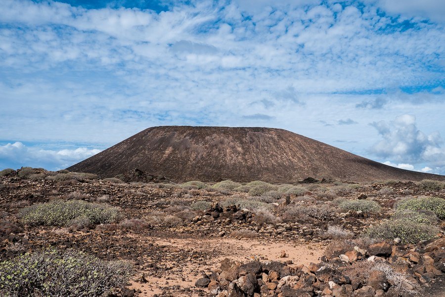
Finally, allow me to introduce you to the Fuerteventura hiking trail that leads to Caldera Mountain. This volcano is situated on Isla de Lobos, a small neighboring island belonging to Fuerteventura, characterized by its beautiful untouched natural landscapes.
To reach Isla de Lobos, you can take this ferry, which includes your permit to visit this protected natural space. Or you can opt for this excursion, which not only includes stops for snorkeling but also gives you free time on the island for hiking. The route starts directly from the dock, so you can’t miss it. First, you’ll arrive at Playa de la Caleta, and from that point, you’ll gradually climb to the top.
10. Isla de Lobos, another impressive place to go hiking in Fuerteventura
If you prefer a guided hike in Fuerteventura, I recommend this excursion. Regardless of your choice, I assure you that once you reach the top, which is about 400 feet high, you’ll be rewarded with postcard-worthy views that you’ll never forget.
- Duration: 3 hours
- Distance: 7.5 miles
- Difficulty: Easy
- Type: Circular
- Elevation gain: 1,076 ft
- Starting point: Isla de Lobos dock
Useful tips for hiking in Fuerteventura
Now that you know the best Fuerteventura walking trails, here are some general tips to keep in mind before starting your hike:
- Remember to wear suitable footwear for trekking in Fuerteventura, preferably high-cut hiking boots. These trails traverse various terrains, so it is absolutely essential to protect your ankles.
- Stay hydrated. Ensure you carry an adequate supply of water for the entire journey, as there are no opportunities to refill along these hiking trails in Fuerteventura.
- Wear a hat, sunglasses, and sunscreen. It’s important to protect yourself from the strong sunlight, especially around midday. Keep in mind that the volcanic stones and lava can become quite hot during the day, so it’s better to start early.
- Consider bringing binoculars, snacks, and a first aid kit.
- Download a travel app that can help you stay on course. We recommend Maps.me, which allows you to access Fuerteventura hiking maps offline.
- Always clean up after yourself and carry your trash with you.
- Don’t forget to charge your camera battery so you can capture some memorable moments.
Map of Fuerteventura hiking routes
Finally, to help you locate all the hikes in Fuerteventura recommended here, I offer you a complete Fuerteventura hiking map. You can download and access this map on your mobile device, even without an Internet connection.
And that concludes our guide to the best hikes in Fuerteventura. If you have any questions or wish to share your experiences exploring one of the best Canary Islands, please feel free to leave a comment below.
Enjoy Fuerteventura!
