When traveling abroad, get a policy from one of the best travel insurance companies. You can get a 5% discount on Heymondo, the only insurance that pays all medical bills upfront for you, HERE!
Tromso is just above the Arctic Circle and is considered the “Arctic Capital” of Norway. If you’re going to visit it, I recommend you get a good map of Tromso, so you can see every single detail.
Although it’s a small city, don’t forget to bring a tourist map of Tromso to locate the places of interest. We visited Tromso for two days before going to the Lofoten Islands, so here are the 7 maps of Tromso, Norway that we used during our trip. You can print them out or use them from your smartphone, even when you’re offline.
Here we go! These are the essential Tromsø maps!
Which Tromso map do you need?
- Tromso tourist map
- Interactive map of Tromso
- Tromso city center map
- Tromso public transport map
- Tromso and surroundings map
- Map of Norway
- Tromso map for downloading
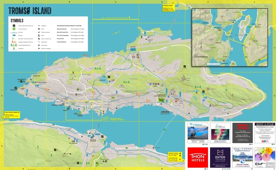
Tromso tourist map
The tourist map of Tromso below is the perfect tool to help you find the main tourist attractions of this beautiful city in the Arctic. This map of the island of Tromso was especially useful for me because it shows the best places to see the Northern Lights.
Interactive map of Tromso
On the following interactive map of Tromso, I’ve marked the main attractions in Tromso. You will find everything from the most important museums to the mountains where you can enjoy the Northern Lights and the midnight sun.
If you think I’ve forgotten an important place, don’t hesitate to leave a comment and I will add it. At the end of the article, I tell you how to use this Tromso map on your cell phone even when you’re offline.
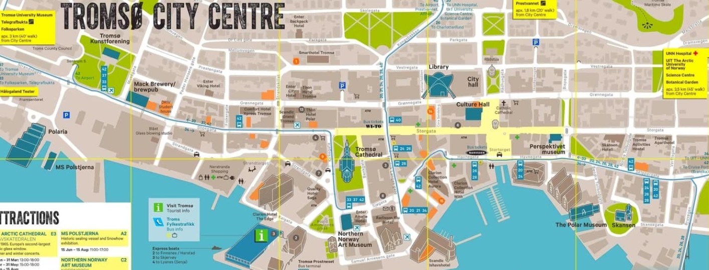
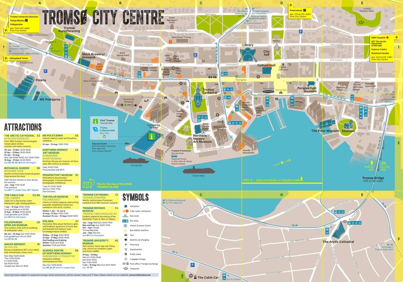
Tromso city center map
On the following Tromso city center map, you’ll find not only the main tourist attractions but also places such as supermarkets, pharmacies, and even bus stops. You can also use this map to check where to stay in Tromso, Norway.
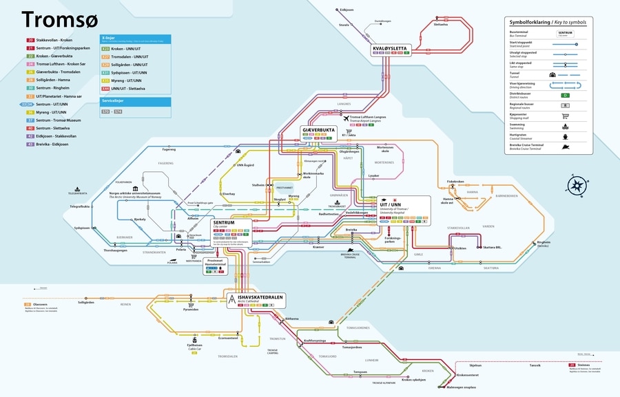
Tromsø public transport map
Although I recommend renting a car to explore Tromso and its surroundings, if you need to take the bus, this Tromso public transport map could be useful.
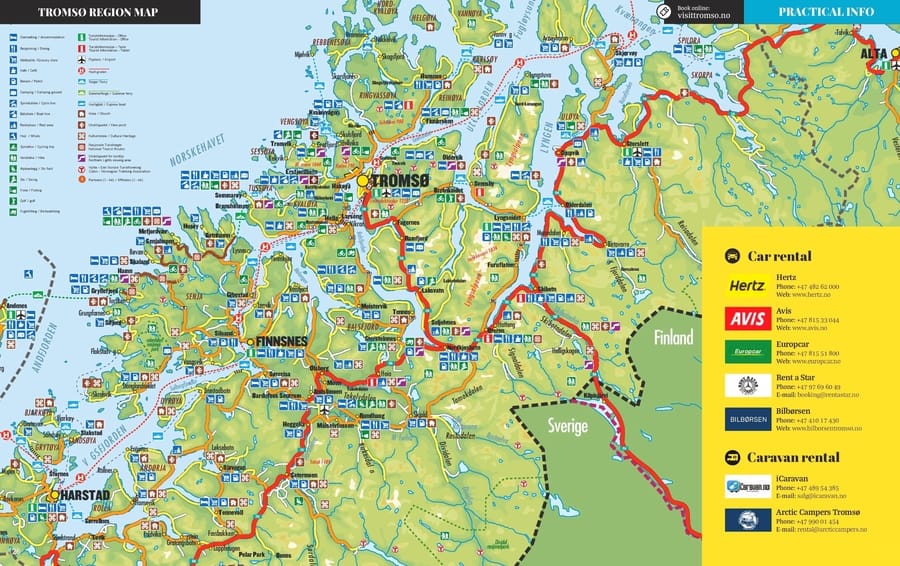
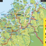
Tromso and surroundings map
Here’s a Tromso regional map so that you can locate this beautiful city within Norway and also get to know its surroundings, something that I recommend you do.
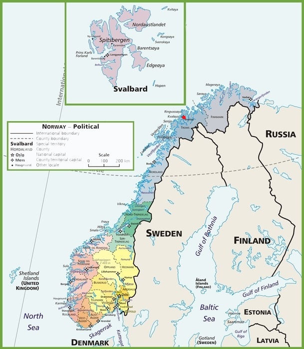
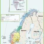
Map of Norway
To give you an idea of where Tromso is on the map, below is a map of Norway. In addition, you can see where the Arctic Circle is located.
Tromso map for downloading
To finish things off, here is a Tromso map for downloading, which I recommend you take with you on your trip so you can check where the best things to do in Tromso are. To have access to it when you’re offline, install the Maps.me and Dropbox apps.
After installation, search for “Tromso” in Maps.me, download the KML file, and save it to Dropbox. Open the file using the Maps.me app to have the interactive map of Tromso that I shared with you available at any time, whether you have an Internet connection or not.
With these Tromsø maps, you have everything you need to plan your trip and make the most of your time in the Arctic Capital.
